


River Nene to River Great Ouse link route
River Nene
The non tidal Nene is navigable from Northampton to Dog in a Doublet sluice just east of Peterborough. Access to the Nene from the inland waterway system is via the Northampton arm of the Grand Union canal.
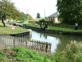
Access from the Nene to the Middle Level is via the lock at Stanground. (48 hours notice required phone the lock keeper, Mr A Rootham, on 01733 566413 for details).
Middle Level (Nene - Ouse navigation link)
Click here for a .jpg map or click here for a pdf map of the Middle level (map courtesy of IWA Peterborough branch).
Boats up to around 60' can wind at the Stanground Lock. Starting from this lock (80'0" x 11'6") the boater travels down the Kings Dyke to Whittlesey. This part of the link is narrow with low banks and wide views over the surrounding fenland interrupted only by the chimneys of the local brick making industry.
There is another winding point up to around 70' at Horsey Toll, about a mile from Stanground Lock.
IIn Whittlesey, Briggate bend is severe and unsighted. The MLC navigation notes recommend landing a crew member to ensure no traffic is coming the other way. Proceed slowly and with caution, and the bend need hold no fears, narrow boats up to 70' have navigated the bend successfully.
On the outskirts of Whittlesey, just before Ashline Lock (90'0" x 11'6", unattended - make certain to buy the special lock handle from the lock keeper at Stanground), there are pleasant moorings on the edge of Manor Fields. From the mooring it is only a short stroll into the town which has a good selection of shops. There is a winding hole, approximately 70' just before reaching the Ashline Lock.
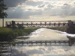
From Ashline Lock, the Whittlesey Dyke runs to Floods Ferry, where it joins the River Old Nene. Turn right here for Ramsey and Bill Fen Marina, or continue on the link by bearing left under an apology for a bridge, towards March (please ensure that you do not hit this bridge. If you do, it will probably fall on you).
Very shortly after joining the Old Nene, you cross the Greenwich Meridian (marked by a sign).
The next town on the route is March. Entering the town under a 60's brutalist era concrete road bridge, there is a sudden change from the remote wild fen landscape to a very urban riverscape, where pretty gardens run down from the towns houses to the waters edge. The river narrows and shallows dramatically as it passes through the town.
The river runs right through the centre of March. Just before the town centre road bridge is a sanitary facility (fresh water, rubbish disposal, chemical WC disposal, pump out) and just after is an attractive town quay with immediate access to The Ship pub at the top of the quay steps. The town centre, with supermarkets, shops and banks, is within 2 minutes sloth like stroll from the quay.
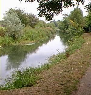
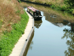
Shortly after leaving March the river widens to around 60', and meanders in a somewhat straight fashion towards Upwell and Outwell.
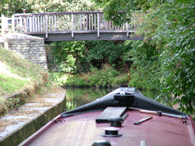
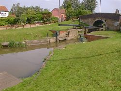
Just before entering the villages you will arrive at the attractive Marmont Priory lock (92'0" x 12'0", attended most of the time, phone Mrs Norton on 01945 773959 in advance to book through). This lock can be operated by the boater when the lock keeper is not in attendance, but even so, advanced notification should be given
There is a winding point for up to 50' just before the lock.
Upwell and Outwell are two pleasant villages that were once one, larger, settlement (Well). The houses have a Dutch style to them and the cruise through the centre of the villages is a peaceful and attractive one.
There are numerous public moorings and staithes although generally these moorings can be a little noisy from road traffic The villages offer some provisioning facilities and, of course, the ever welcome public houses. St Peters church at Upwell is worth visiting.
At Outwell boat basin, boats up to 70' can wind.
Well Creek runs from Outwell, through the attractive village of Nordelph, to Salters Lode Lock (boats up to 70' can wind near Nordelph highway bridge). On the way the creek passes over the Middle Level main drain on Mullicourt aqueduct, the only aqueduct in the Middle Level system.
Salters Lode Lock(62'0" x 12'6". Attended - ring the lock keeper on 01366 382292 for passage times) leads from the Middle Level onto the tidal River Great Ouse. Most craft turn right after passing through the lock and run up to Denver Sluice onto the non tidal Ouse.
Denver Sluice (29.5m x 5.4m) is attended and the lock keeper must be phoned ( 01366 382340 ) before attempting passage between Salters Lode Lock and the sluice.
These notes are aimed at assisting the boater and Bill Fen Marina can accept no responsibility if they are used for navigation purposes. Boaters should obtain the latest Middle Level commissioners navigation notes and/or one of the published guides to the Middle Level.